for those who love the outdoors
2 April, 2024
In times of crisis, especially when on an adventure, the use of GPS tracking in emergency response has proven to be invaluable.

GPS technology plays a crucial role in mapping disaster areas and improving coordination among rescue teams. This article explores the advantages of GPS tracking, such as real-time location information and faster response times, while also addressing challenges like technology limitations and privacy concerns.
Join us as we delve into the future of GPS tracking in emergency response, including advancements in technology and the potential for global use.
Real-time location information provided by GPS tracking allows for faster response times and improved coordination during emergencies.
GPS tracking enhances the safety of first responders by providing accurate and up-to-date information on their locations.
Although there are limitations and challenges to implementing GPS tracking in emergency response, advancements in technology and potential for global use show promise for its future impact.
GPS tracking plays a critical role in emergency response scenarios by providing real-time geolocation data for efficient coordination and swift action. Other than this, it has more uses in emergency response which may include:
By deploying GPS tracking devices, authorities can accurately pinpoint the locations of first responders in real-time, allowing for quick decision-making and resource allocation. Tracking first responders using GPS technology enhances response time and enables efficient monitoring of their movements during critical situations.
The ability to track responders not only boosts their safety by providing constant oversight but also streamlines coordination efforts among multiple teams. The data collected from GPS devices can be analyzed to optimize future emergency response strategies, ultimately paving the way for more effective crisis management.
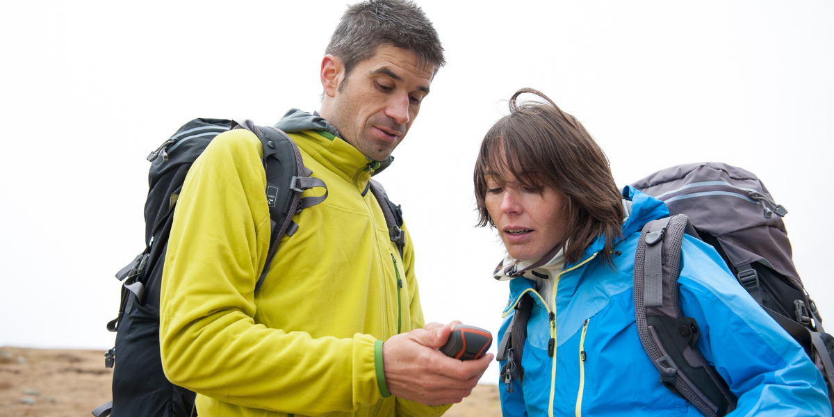
During catastrophes such as earthquakes, hurricanes, or floods, the ability to pinpoint the exact location of those in need is crucial for swift and efficient response. GPS technology, through devices like smartphones, smartwatches, or dedicated GPS trackers, plays a pivotal role in this process.
By transmitting real-time coordinates, these devices help emergency responders navigate through chaotic environments and reach victims quickly. GPS-enabled communication tools facilitate the establishment of a seamless link between distressed individuals and rescue teams, ensuring effective coordination and timely aid delivery.
GPS tracking technology enables comprehensive mapping of disaster areas, utilizing GPS systems and tracking devices to create accurate visual representations for better resource allocation.
Using GPS tracking technology, emergency responders can gather real-time data on the ground to pinpoint areas needing immediate attention. GPS systems play a crucial role in providing precise location information, allowing for effective deployment of resources.
Tracking devices carried by individuals or attached to aid vehicles enable teams to monitor movement patterns and identify high-risk zones. This data is then used to generate detailed maps that assist in developing response strategies, ensuring that resources are distributed efficiently.

The advantages of using GPS tracking in emergency response scenarios are manifold, including real-time location data that enhances safety and expedites rescue operations.
Real-time location information provided by GPS tracking systems allows emergency responders to pinpoint the exact whereabouts of individuals in distress swiftly. By leveraging the capabilities of GPS technology, responders can not only locate those in need but also determine the most efficient route to reach them, reducing response times significantly. It enables responders to make informed decisions on resource allocation and deployment, ensuring that help reaches those in distress without delays.
GPS tracking contributes to faster response times in emergencies by optimizing route planning, monitoring vehicle locations, and streamlining overall operational efficiency. By leveraging GPS technology, emergency responders can strategically deploy resources based on real-time insights, ensuring that the nearest units are dispatched promptly while constant geospatial data tracking allows for continuous monitoring of response times and quick adjustments to optimize efficiency.
With the integration of GPS technology into emergency response operations, teams can easily pinpoint the exact location of incidents or individuals in need of assistance. This real-time tracking capability allows for swift deployment of resources, optimizing response times and overall efficiency. By leveraging GPS signals, teams can communicate effectively, ensuring everyone is on the same page and tasks are assigned based on proximity and expertise. This streamlined approach enhances collaboration and coordination, leading to quicker and more organized emergency responses.
Through the utilization of GPS tracking devices, first responders can gain real-time visibility into the location and status of their essential equipment and vehicles, ensuring they have the necessary tools for any emergency. With the ability to monitor the movements of personnel, dispatchers can ensure efficient coordination, quick response times, and improved communication during critical incidents. By proactively identifying risks such as route deviations or delays, responders can take necessary precautions to avoid any potential dangers, ultimately enhancing overall safety and operational effectiveness.
Despite its benefits, GPS tracking in emergency response faces challenges and limitations such as technology constraints and privacy concerns that need to be addressed for effective implementation.
One of the primary constraints faced by GPS tracking systems involves the potential for signal loss, especially in areas with limited satellite coverage. This can result in gaps in location data, hampering the real-time tracking of vehicles or individuals during emergencies. The accuracy of GPS signals can be affected by environmental factors such as tall buildings or dense foliage, further complicating the reliability of location information. These issues not only slow down response times but also jeopardize the effectiveness of emergency services in reaching those in need.
With the increasing integration of GPS technology in various aspects of daily life, individuals are faced with the dilemma of balancing convenience with privacy protection. The constant tracking of movements and locations through GPS devices poses a significant risk of unauthorized access to sensitive personal information, leading to concerns about data breaches and potential misuse of this data. The ethical implications of using GPS information in emergencies raise complex ethical dilemmas regarding consent, transparency, and accountability.
One of the main financial obstacles faced by emergency response organizations when it comes to implementing GPS tracking systems is the initial investment required to acquire the technology and set up the infrastructure. This can pose a significant budgetary strain, especially for smaller agencies or those operating on limited funds. Plus the cost factor, and logistical challenges such as integrating the GPS technology with existing systems, training staff on the new tools, and ensuring data accuracy and reliability can further complicate the implementation process.
The future of GPS tracking in emergency response looks promising, with ongoing technological advancements and integration possibilities that can revolutionize response strategies on a global scale. The integration of GPS technology with real-time communication systems enables quicker and more efficient coordination during emergencies. GPS Trackers also offer features like geofencing, enabling responders to set virtual boundaries and receive alerts when a target enters or leaves a designated area. These innovations not only improve response times but also enhance overall safety for both responders and those in need.
Frequently Asked Questions
'From Rescue to Recovery: GPS Tracking in Emergency Response' refers to the use of GPS technology in emergency response situations, from the initial rescue stage to the recovery and rebuilding phase.
GPS tracking provides real-time location data, which can help emergency responders quickly locate and reach those in need. It also allows for efficient coordination and navigation during emergency operations.
Yes, GPS tracking can be used in a wide range of emergencies, including natural disasters, search and rescue operations, and medical emergencies. It is a versatile tool that can be adapted to various needs.
Some of the main benefits of using GPS tracking in emergency response include improved efficiency, faster response times, and increased safety for both responders and victims. It also allows for better data collection and analysis for future emergency planning.
In the recovery and rebuilding stage, GPS tracking can be used to assess damage and track the progress of relief efforts. It can also aid in identifying areas that are still in need and directing resources accordingly.
While there are costs associated with implementing GPS tracking technology, it can also save money in the long run by increasing the efficiency and effectiveness of emergency response. It can also help prevent further damage and loss of life, making it a valuable investment.

Outside & Active is the home for those who love the outdoors. Our mission is to inspire, inform and educate people about being active outdoors in a fun, safe and sustainable way. We provide inspiration, kit, tech and advice on adventure, camping, climbing, cycling, hiking, running water and winter.
Most recent articles by Outside & Active
Most recent articles in ADVENTURE